Reduce Settlement Time
Combine real-time data sources with spatial and actuarial datasets to reduce time from FNOL to settlement
Kinetica is changing the game for how insurance companies evaluate risk, respond to major weather events, and expedite the claims settlement process.
Kinetica is a real-time geospatial database that leverages advanced vectorized technology. It's being used with large insurers for faster and more sophisticated analysis of property claims from weather events with full location context.
Combine real-time data sources with spatial and actuarial datasets to reduce time from FNOL to settlement
Direct claims adjusters to areas most likely to be impacted. Provide insight ahead of the weather event that helps predict potential loss.
Leverage machine learning models with real-time data to identify discrepancies between claims and predicted damages.
Modernize Property & Casualty Insurance: A Live Demo from Kinetica
The same claims picture, before and after Kinetica — batch-and-summarized dashboards give way to a real-time, detailed view.
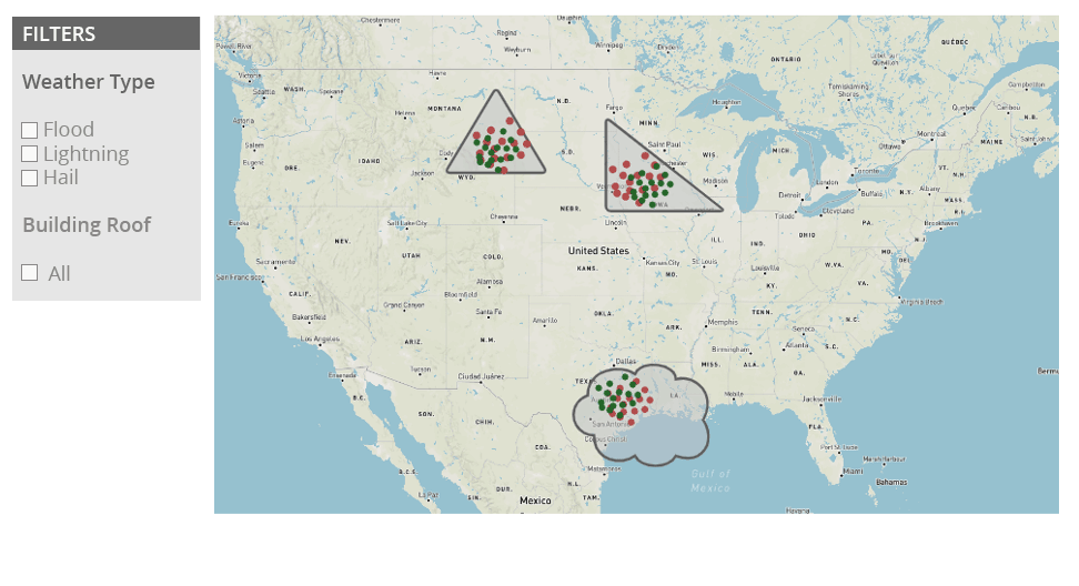
BEFORE: Batch & Summarized Data
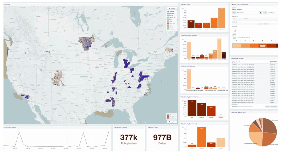
AFTER: Real-time & Detailed
When damaging weather events occur, an insurer's response can make or break a policyholder's experience and the insurer's bottom line.
In this example, you can see how one insurer gets ahead of potential claims by analyzing how real-time weather events are affecting policies.
Kinetica and AWS provide the components to modernize claims management using real-time location intelligence.
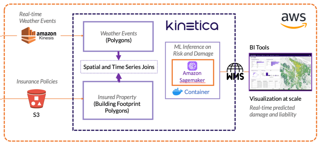
Insurance companies need to make good decisions based on vast quantities of location related data. Kinetica makes it quicker and easier to collate, fuse, and visualize that data for better analysis and more responsive event handling.
Kinetica's lockless architecture, distributed ingestion, and vectorized query enable you to work with numerous sources of spatial and streaming data. Kinetica allows for simultaneous ingest and query, and avoids the need for constant re-indexing and re-aggregations as new data changes the picture.
Kinetica combines time-series, spatial, and graph capabilities into a unified database available through a SQL & Postgres compatible interface. Over 130 geospatial functions, geo-joins, graph solving and matching makes analytics on spatial and time series data at scale easier and faster.
Kinetica's vectorized capabilities enable analysts and engineers to analyze and deploy systems quicker than ever. Vectorized algorithms allow for simpler data structures, which means less time engineering the data, more flexibility for exploring the data, and lower compute costs.


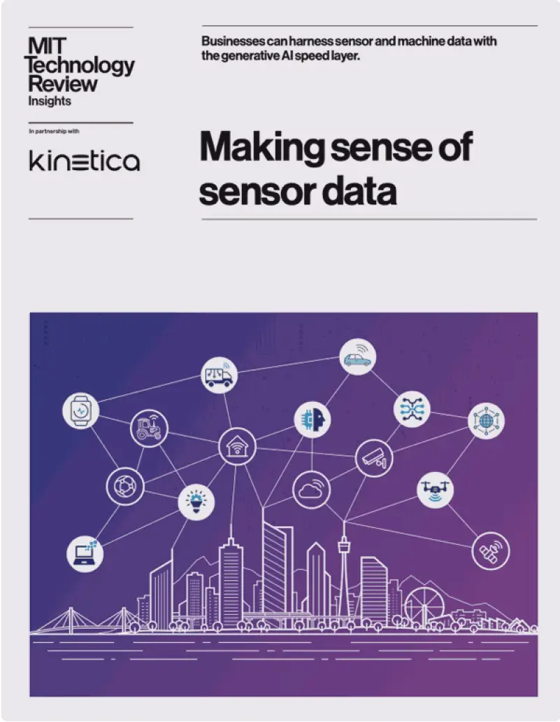
As sensor data grows more complex, legacy data infrastructure struggles to keep pace. A new set of design patterns to unlock maximum value. Get this complimentary report from MIT Technology Review
To provide the best experiences, we use technologies like cookies to store and/or access device information. Consenting to these technologies will allow us to process data such as browsing behavior or unique IDs on this site. Not consenting or withdrawing consent, may adversely affect certain features and functions. Cookie Policy