What's New
Go to: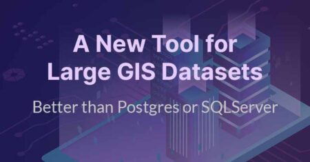
Today, many GIS users jump out of their systems and use Postgres or SQLServer to run spatial queries on larger datasets. While this is a nice workaround, this approach is limited in both scale and ease of use. With Kinetica, the power of geospatial analysis, viewing, and query on large geospatial datasets can be used…
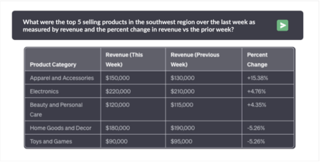
The desire to query enterprise data using natural language has been a long-standing aspiration. Type a question, get an answer from your own data. Numerous vendors have pledged this functionality, only to disappoint in terms of performance, accuracy, and smooth integration with current systems. Over-hyped solutions turned out to be painfully slow, causing frustration among…

In the rapidly evolving landscape of data analytics and artificial intelligence, one technology has emerged as a game-changer: Graphics Processing Units (GPUs). Traditionally known in the data science community for their role in accelerating AI model training, GPUs have expanded their reach beyond the confines of deep learning algorithms. The result? A transformation in the…
In an era marked by growing concerns about environmental sustainability, companies across industries are seeking innovative ways to reduce their carbon footprint and contribute positively to the environment. Kinetica stands out as a trailblazer in this pursuit, particularly in the realm of compute efficiency and energy optimization. Let’s delve into how Kinetica is making substantial…
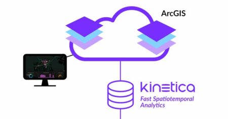
Esri’s ArcGIS is renowned as a robust solution for creating, managing, and analyzing geospatial data. With its comprehensive functionality and impressive capabilities, it has become the platform of choice for organizations that build GIS systems. From establishing spatial relationships to automating assets like utility networks and examining natural phenomena such as wetlands, ArcGIS excels at…
In the press